Smart City App
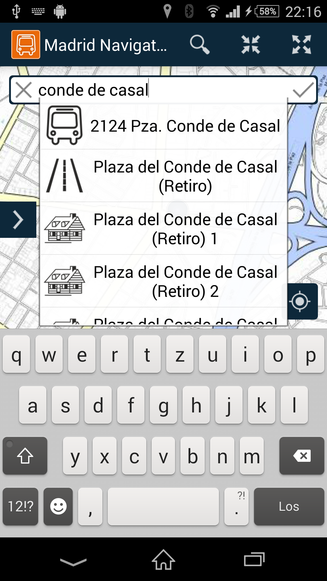
Madrid Navigator was developed as part of the EU project GAMBAS. Madrid Navigator is a free application that delivers step-by-step navigation through Madrid. Different data sources are integrated with map display, routing and navigation.
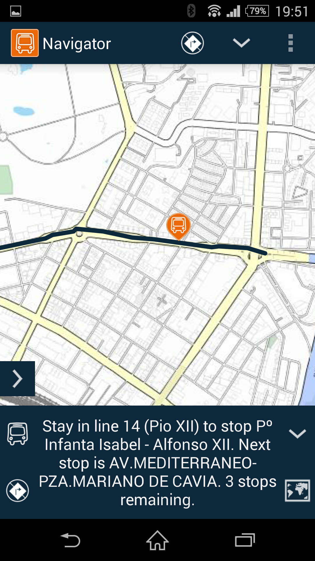
In addition, the application can identify in which bus the passenger is located by means of an extremely precise, WLAN-based location identification of the user. The user thus has the opportunity to see if he has boarded the wrong bus. If this is the case, alternative routes can be calculated in order to reach the desired destination in the quickest possible way.
Passenger data, which is automatically captured on the bus using an embedded system developed by LocosLab, allows Madrid Navigator to provide information about bus network utilization and to identify if additional buses may be needed for a line.
In order to guarantee the best possible data protection, the data of the passengers is thereby anonymized.
Services
- Map visualization
- Passenger estimation
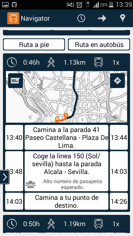
- Routing
Applications
- Passenger detection (Embedded)
- Navigation (Android)
Experience Madrid via bus!
The Android application enables precise multimodal navigation while taking the utilization of the bus network
into account.
Notes
Google Play and the Google Play logo are trademarks of Google LLC.